Showing posts with label Victoria. Show all posts

Thursday, September 8, 2011

On to South Australia

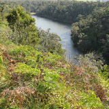
Lower Glenelg (in Victoria near border)

Although a fairly quite road between Portland and Nelson, it has huge areas of pine plantations and quite a number of log trucks as a consequence. The pines have replaced the native bush, which is sad to see, and some have escaped into the national parks.
The walk along the cliff top of the Glenelg River was pleasant with several sections of large cliff. I was sure the walk started off in an easterly direction, so that is the way we went. There were good cliffs and views, but after a while we couldn’t match the scene to the book and on reaching a 4wd track realised that we went the wrong way. We walked back along the 4wd to the start and then commenced in the correct direction for the walk to the Glenelg River Gorge. We decided that the scenery was just as good the original way, so we had a better walk by seeing the two sections of river.
Lower Glenelg


Cananda and Little Dip

From Nelson it was not that far to drive to reach Mount Gambier in South Australia, where we were surprised by the size of Blue Lake. It is quite a sizeable old crater, certainly a lot bigger that the ones we visited in Victoria. It was a windy day and there always seemed to be rain up ahead, but fortunately it kept moving ahead faster than us. A walk around Cape Buffon was quite interesting with the distorted weather worn coastal rock stacks and undercut cliffs. Next up came Little Dip and a circuit walk of Freshwater Lake. It seems that the Parks Service and the Friends of Little Dip lost enthusiasm for the track as it was very overgrown. The night was spent in Robe, which has quite a few heritage buildings, but it started to rain heavily and we had to be content with viewing them from the car.
Canunda Little Dip

Coorong
North of Robe is the Coorong and here we visited some lakes and after that drove on to Victor Harbour for the night; an obviously popular seaside holiday and retirement town.
Coorong

Deep Creek
In very nice weather we spent a few hours in a walk in Deep Creek. The flora was quite spectacular along the track to Deep Creek Cove.
Deep Creek


Sunday, September 4, 2011

South Western Victoria


On approaching Hamilton many of the farms had dry rock walls surrounding paddocks, rather than wire fences; it was amazing the work that must have gone in to it.
First walk was to Mount Napier, which is the site of a volcano and at the summit there is the remains of the crater. More impressive though was Budj Bim also known as Mount Eccles National Park, for here one of the craters is filled with the waters of Lake Surprise and as well there are old lava canals snaking over the land.
A photo album of the Budj Bim park
Budj Bim - Mount Eccles

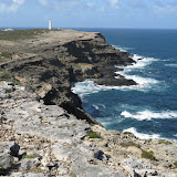
We arrived on the coast at Portland, and not far from there is the Cape Nelson State Park. On driving there the first dramatic feature was the numerous wind turbines right up to the boundary of the reserve. Once we started walking the swishing sound of the turbines was quite noticeable; at first we thought it was a plane flying over. The walk was a circuit through the mallees to the cliff edge then along the edge to a lighthouse. The track continued on before crossing through a tunnel of vegetation back to the car.
A photo album of the Cape Nelson park

Cape Nelson


Thursday, October 7, 2010

Northern and Southern Grampians

After the Victoria Range we went on the Halls Gap where the highlight was climbing Mt Garr.
IMG_4236
On the way to Mt Garr
IMG_4258
Cliffs of Mt Garr
 
IMG_4263
Climbing  to Mt Garr
IMG_4271
Summit ridge of Garr looking to rocky tor
We also went to Chinamans Wall where there were obvious signs of rockclimbing hardware (bolts dried in walls and white powder marks)
IMG_4317 Domes on top
Domes Chinamans Wall
Finally it was down to the southern end of the Grampians and a climb up Murdajdoog (Mt Abrupt)
IMG_4336 Signal Peak 
Signal Peak from Mt Abrupt

IMG_4338
On the way to Mt Abrupt - Murgadjoog


Wednesday, October 6, 2010

Western Grampians Area

From Canberra we travelled south west to cross the Murray River at Barham, where the river was to the top of the bank.
IMG_5766 Barham
River Murray at Barham
Our first park to visit was Djurite (Mt Arapiles) where we were surprised by the large numbers of rock climbers camped there. Apart from the cliffs it is a place of nice flowers.
IMG_4052
Mint bush below cliffs at Arapiles
IMG_5817
Rock climbers camp at Arapiles
Next came Burrunj (Black Range) again featuring cliffs and wildflowers.
IMG_4083
Burrunj cliffs

In the Victoria Range is the spectacular Fortress
IMG_4123
Fortress
IMG_4151
Fortress
And a little further south on the range is the Chimney Pots

IMG_4183 Chimney Pots
Chimney Pots cliffs